+256 700 123 456info@geoworldsurveyors.comMon - Fri: 8AM - 6PM
    RICSISO 9001ISUNLS
    Geo World Surveyors
    Home
    Services
    Company
    Resources
    Contact
    1. Home
    2. Services
    3. Boundary Opening
    Our Services

    Boundary Opening

    Our boundary opening service is the process of physically marking and defining the boundaries of a titled or mapped parcel of land on the ground. We identify an...

    Boundary Opening
    Boundary Opening
    Overview

    About This Service

    Our boundary opening service is the process of physically marking and defining the boundaries of a titled or mapped parcel of land on the ground. We identify and verify property corners, boundary lines, and other reference points that determine the property's limits. This is critical for property owners who need to confirm exactly where their land begins and ends — whether for fencing, construction, or resolving disputes with neighbors. Our process includes obtaining cadastral prints, geo-referencing to UTM coordinates using AutoCAD, and preparing detailed boundary maps.

    4

    Process Steps

    5

    Key Benefits

    Technology & Systems

    AutoCADGPS/GNSS ReceiversUTM Coordinate SystemCadastral Print SystemsBoundary Marking Equipment
    Our Process

    How It Works

    Our proven 4-step process ensures accuracy, compliance, and quality results for every project.

    Step 1

    Reconnaissance & Records

    Initial site reconnaissance followed by obtaining the cadastral print and all details including plot and block number, volume and folio from the land registry.

    1
    1
    Step 2

    Geo-Referencing

    The cadastral print is geo-referenced to UTM coordinate data using AutoCAD. System data for the old title is obtained and verified against current ground conditions.

    2
    2
    Step 3

    Boundary Map Preparation

    A map showing the extent of boundary lines, area, and distances between each point is prepared and printed. Where required, an introductory letter is written to relevant authorities.

    3
    3
    Step 4

    Physical Demarcation

    On-site physical marking and verification of all boundary points, confirming property corners and boundary lines match the prepared maps and cadastral records.

    4
    4
    Key Benefits

    Why Choose This Service

    • Physically marks exact property boundaries on the ground
    • Geo-referenced to UTM coordinates for legal precision
    • Resolves boundary uncertainties before construction or fencing
    • Detailed boundary maps with distances between all points
    • Authority liaison where approvals are required
    Boundary Opening

    Boundary Opening

    Professional surveying services you can trust
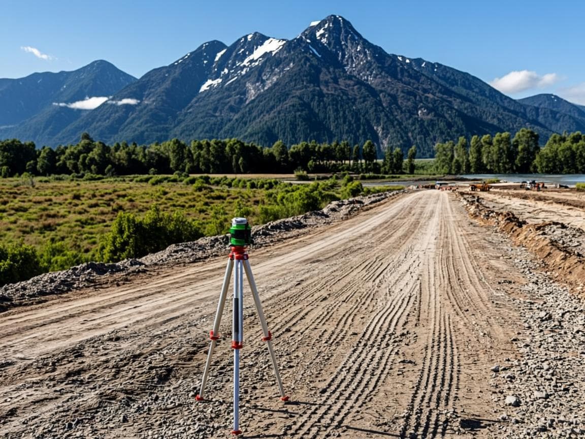
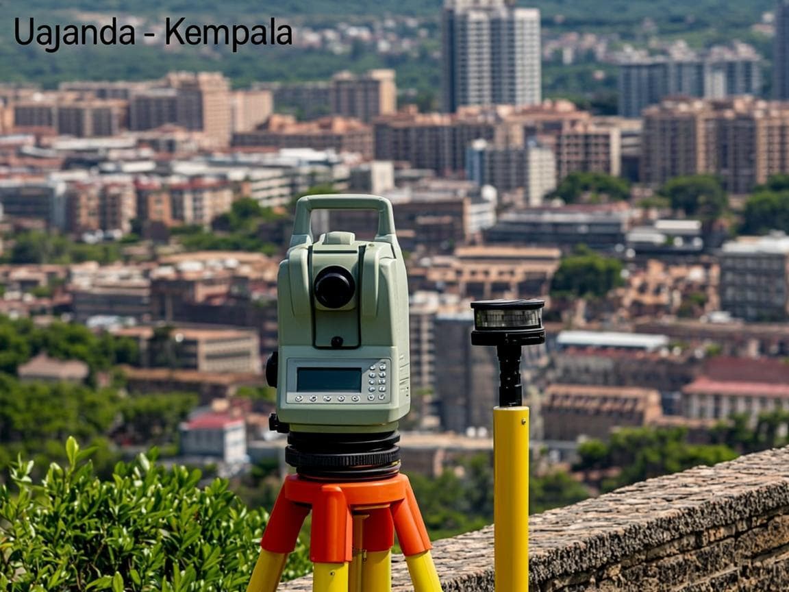
    AutoCAD
    GPS/GNSS Receivers
    UTM Coordinate System
    Cadastral Print Systems
    Portfolio

    Service in Action

    See how we have applied our boundary opening expertise in real projects across Uganda.

    Disputed Land Demarcation

    Disputed Land Demarcation

    Rwenzori Foothills

    District Boundary Survey

    District Boundary Survey

    Kabarole

    Estate Subdivision

    Estate Subdivision

    Family Land

    View Full Portfolio
    FAQ

    Frequently Asked Questions

    Common questions about our boundary opening service.

    Explore More

    Related Services

    Discover our other professional surveying and title services.

    Preliminary Surveys

    Preliminary Surveys

    Our preliminary survey service provides an initial investigation and assessment of a property or land parcel to gather i...

    Learn More
    Title Processing

    Title Processing

    Our title processing service covers the full legal and administrative procedures for registering, transferring, or modif...

    Learn More
    Title Transactions

    Title Transactions

    Our title transactions service handles the full range of property ownership changes and registrations in Uganda. Whether...

    Learn More

    Ready to Get Started?

    Contact us today to discuss your boundary opening requirements and get a tailored solution for your project.

    Stay Updated on Land Matters

    Get expert insights on surveying, title processing, and land governance in Uganda.

    Geo World Surveyors

    Professional land surveying & real estate solutions fostering land ownership and planned development across Uganda.

    +256 700 123 456
    info@geoworldsurveyors.com
    Fort Portal, Western Uganda

    About

    • Our Story
    • Our Team
    • Certifications
    • Careers

    Services

    • Preliminary Surveys
    • Title Processing
    • Title Transactions
    • Cadastral Surveying
    • Topographic Surveying
    • Boundary Opening
    • Subdivision & Demarcation
    • Real Estate

    Resources

    • Blog
    • Case Studies
    • Whitepapers
    • FAQ

    Certifications

    RICS
    ISO 9001
    ISU
    NLS

    © 2026 Geo World Surveyors. All rights reserved.

    Geo World Surveyors