+256 700 123 456info@geoworldsurveyors.comMon - Fri: 8AM - 6PM
    RICSISO 9001ISUNLS
    Geo World Surveyors
    Home
    Services
    Company
    Resources
    Contact
    1. Home
    2. Services
    3. Preliminary Surveys
    Our Services

    Preliminary Surveys

    Our preliminary survey service provides an initial investigation and assessment of a property or land parcel to gather information and identify potential issues...

    Preliminary Surveys
    Preliminary Surveys
    Overview

    About This Service

    Our preliminary survey service provides an initial investigation and assessment of a property or land parcel to gather information and identify potential issues before proceeding with a more detailed survey or development. This is usually done to verify property boundaries, identify potential issues, gather relevant property data, and determine full survey requirements. A preliminary survey is the essential first step for any land transaction or development project in Uganda.

    4

    Process Steps

    5

    Key Benefits

    Technology & Systems

    GPS with AccessoriesAutoCADGNSS ReceiversSite Mapping Software
    Our Process

    How It Works

    Our proven 4-step process ensures accuracy, compliance, and quality results for every project.

    Step 1

    Reconnaissance / Site Visit

    We visit the site to determine the scope: purpose of the survey, which equipment to use, which data to collect, the day and time of execution, and details to indicate on the site plans.

    1
    1
    Step 2

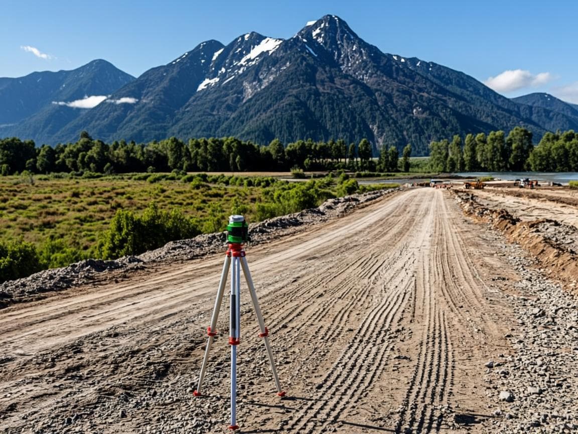
    Field Data Collection

    Moving along known boundary lines with GPS equipment and picking coordinates on every corner. We identify acreage, land status, physical features, and developments on the land.

    2
    2
    Step 3

    Map Production

    Construction of site plans and maps to determine acreage, land status, drainage, physical features, and developments. A final preliminary map is produced within 2 days.

    3
    3
    Step 4

    Deliverables

    Final preliminary survey print layout, fully signed and stamped by the Senior Physical Planner and Surveyor, ready for submission to land authorities.

    4
    4
    Key Benefits

    Why Choose This Service

    • Quick turnaround — preliminary maps within 2 days
    • Affordable pricing: UGX 250,000 within Fort Portal, UGX 300,000 outside
    • Identifies boundary issues before costly disputes arise
    • Essential foundation for title processing applications
    • Accurate acreage determination for land transactions
    Preliminary Surveys

    Preliminary Surveys

    Professional surveying services you can trust

    GPS with Accessories
    AutoCAD
    GNSS Receivers
    Site Mapping Software
    Portfolio

    Service in Action

    See how we have applied our preliminary surveys expertise in real projects across Uganda.

    Boundary Dispute Resolution

    Boundary Dispute Resolution

    Rwenzori Foothills

    Terrain Mapping

    Terrain Mapping

    Kabarole District

    Leasehold Processing

    Leasehold Processing

    Fort Portal

    View Full Portfolio
    FAQ

    Frequently Asked Questions

    Common questions about our preliminary surveys service.

    Explore More

    Related Services

    Discover our other professional surveying and title services.

    Title Processing

    Title Processing

    Our title processing service covers the full legal and administrative procedures for registering, transferring, or modif...

    Learn More
    Title Transactions

    Title Transactions

    Our title transactions service handles the full range of property ownership changes and registrations in Uganda. Whether...

    Learn More
    Cadastral Surveying

    Cadastral Surveying

    Our cadastral surveying service defines property boundaries with legal precision for land registration, dispute resoluti...

    Learn More

    Ready to Get Started?

    Contact us today to discuss your preliminary surveys requirements and get a tailored solution for your project.

    Stay Updated on Land Matters

    Get expert insights on surveying, title processing, and land governance in Uganda.

    Geo World Surveyors

    Professional land surveying & real estate solutions fostering land ownership and planned development across Uganda.

    +256 700 123 456
    info@geoworldsurveyors.com
    Fort Portal, Western Uganda

    About

    • Our Story
    • Our Team
    • Certifications
    • Careers

    Services

    • Preliminary Surveys
    • Title Processing
    • Title Transactions
    • Cadastral Surveying
    • Topographic Surveying
    • Boundary Opening
    • Subdivision & Demarcation
    • Real Estate

    Resources

    • Blog
    • Case Studies
    • Whitepapers
    • FAQ

    Certifications

    RICS
    ISO 9001
    ISU
    NLS

    © 2026 Geo World Surveyors. All rights reserved.

    Geo World Surveyors